Manistee River Trail - April 2017
Summary
The Manistee River Trail or commonly referred to as the MRT is probably the most popular trail in Michigan’s Lower Peninsula. It is a loop trail connected to the North Country Trail. Because of this connection, you can experience this trail in a number of different ways. As an out and back, a loop, or one-way hike. Most people typically hike this as a loop in 1-2 days.
Where
The MRT is located in the Northern Lower Peninsula on the west half of the state. The closest major town is Cadillac, but I think the closest village would be Mesick, MI.
Logistics
There are a few entry points to get on this loop, so logistics are not overly challenging for this trail. It is very popular so going in peak hiking months could cause parking challenges. Aside from that, the trail offers many camping options, especially on the less restricted NCT side. On this hike, we started our journey at the northernmost section of the loop and hiked counterclockwise, hiking the NCT side first, then the MRT on day 2.
Hiking
For the lower peninsula, this hike offers some challenging terrain and rolling hills. Keep in mind, this is “challenging” for this area, not in general. This is not “summiting a 14er” challenging, but for the area and for those new to hiking, it will be at least noticeably different from most trails in this region. There are no issues with finding campsites/water along this trail as you are close to the river or outlets of the river throughout the entirety of the trail. The NCT side offers less views of the Manistee river, but does offer quite the elevation gain/change. It is more challenging and remote. On our hike, we started here, missed our turn, and eventually made it to Red Bridge River Access Site. This was home for the night after Day 1.
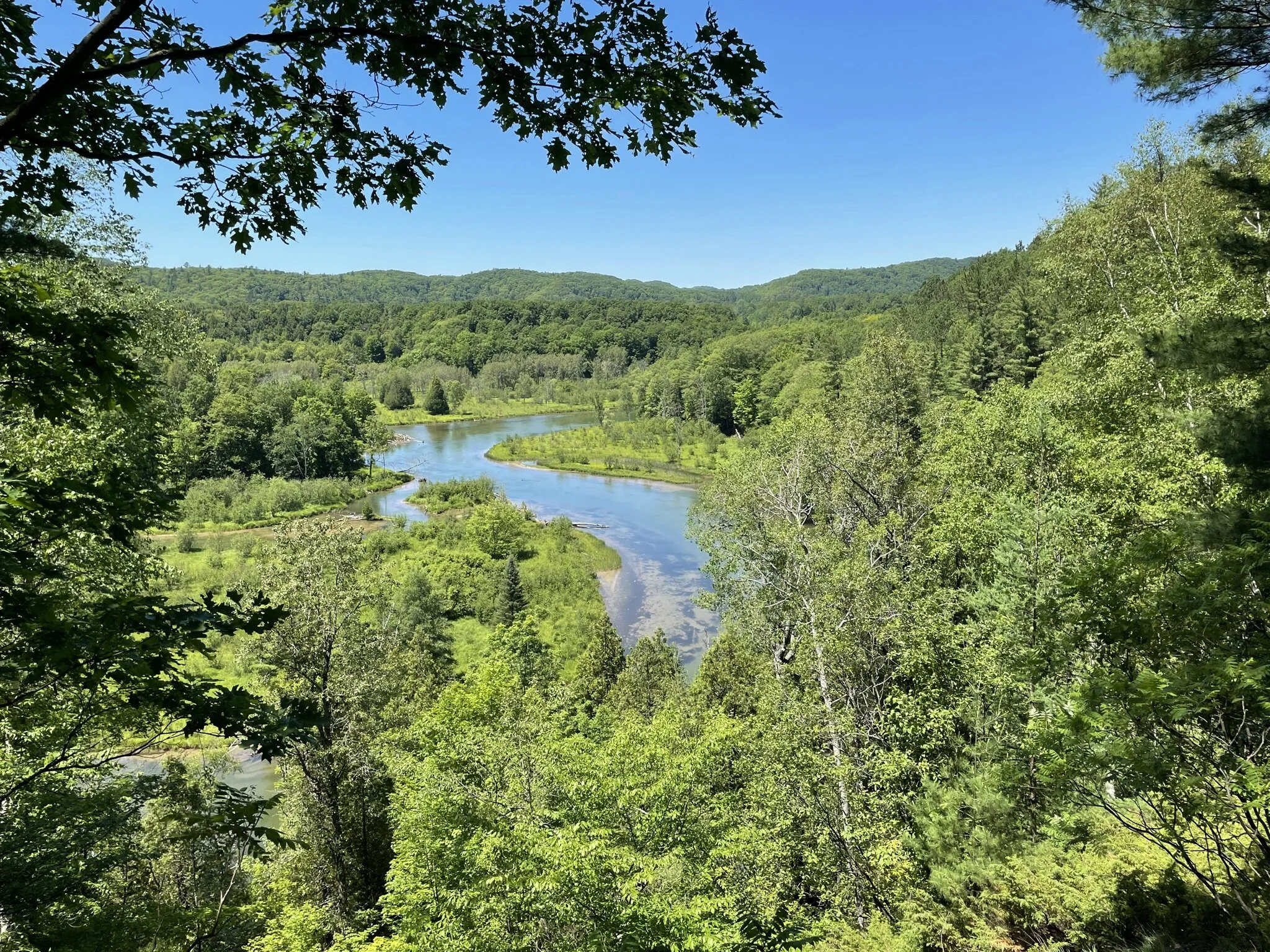
On Day 2, we hiked exclusively on the MRT side of the trail, which was a pleasant change of pace. Great views of the river, easier elevation change, and additional informational posts and sights to see (a small waterfall). At the end of this hike we reflected on the loop, the challenges, and our gear. We were still very much learning about base weight and what we needed to hike for a weekend trip. Needless to say, we still had a lot of learning ahead of us, but we were getting there!
Photos
I used my iPhone 7 to take pictures on this hike and later realized how much of a pain it is to convert live photos to still photos, therefore I have a short video below.