Titcomb Basin / Knapsack Col - July 2021
Summary
The Titcomb Basin and Knapsack Col are popular sections of the central region of the Wind River Range. They are known by mountain lovers by their sharp appearance. This hike was the main hike of our vacation, and we spent 3 days and 2 nights enjoying this region of the Winds.
This AllTrails link covers a large portion of what we hiked in our time on this 3 day trip. We deviated slightly from this hike going deeper into the Knapsack Col region and up into the Indian Basin as well. We averaged 15 miles per day over the 3 days of hiking, which would put us at 45 miles compared to following this route directly (30).
Where
Titcomb Basin and Knapsack Col are mountain features in the Wind River Range in Wyoming, in the United States. The closest town to this region is Pinedale, Wyoming, however this region is 15 miles from the closest trailhead and 20 minutes into Pinedale from there. Like Cirque of the Towers, this is a pretty remote region.
Logistics
We stayed at Trail’s End Campground to help make logistics easier for the start of this 3 day trip. Trail’s End is a rustic campground with minimal amenities (picnic table, fire ring, and vault toilet). Thankfully this campground is walking distance to the Elkhart Park trailhead, which is the official start and end of our 3 day adventure. This made starting early on Day 1 very easy! With that being said, as mentioned above, this area is very remote. We did not have any cell service at Trail’s End or at any time throughout our 3 day hike. This area is known bear country and trail registry entries showed active bear activity both on trail and at night (campsite raids). It was based on this recent intelligence that we decided to carry our bear cans and arm one member of our group with bear spray. Having little bear experience between the three of us, it felt like the right decision!
Hiking
Day 1 - Elkhart Park to Island Lake
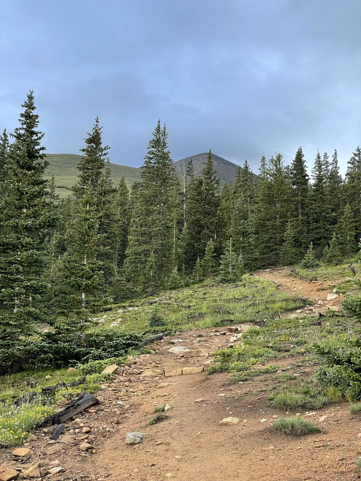
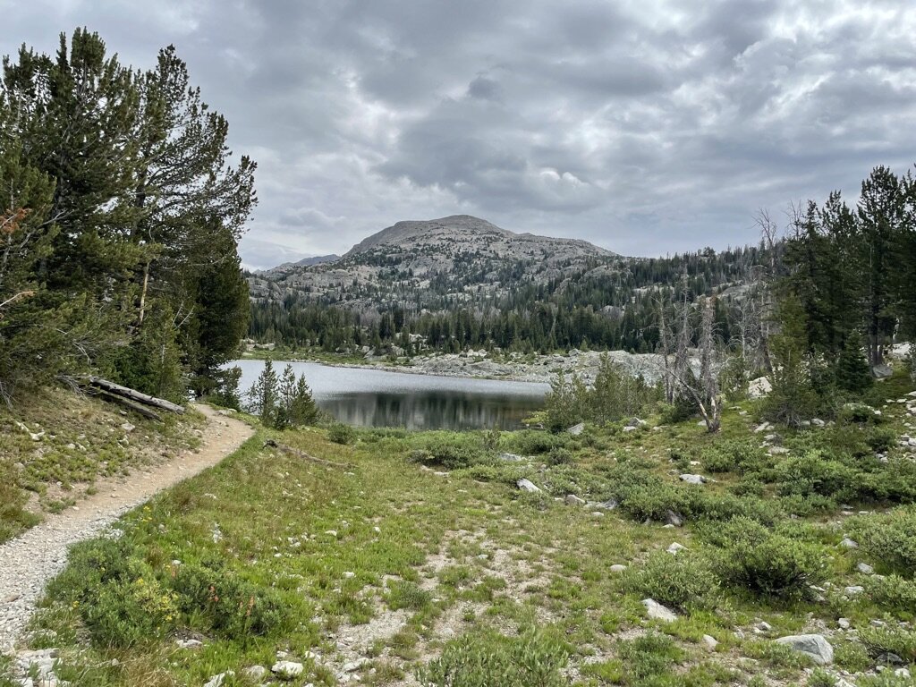
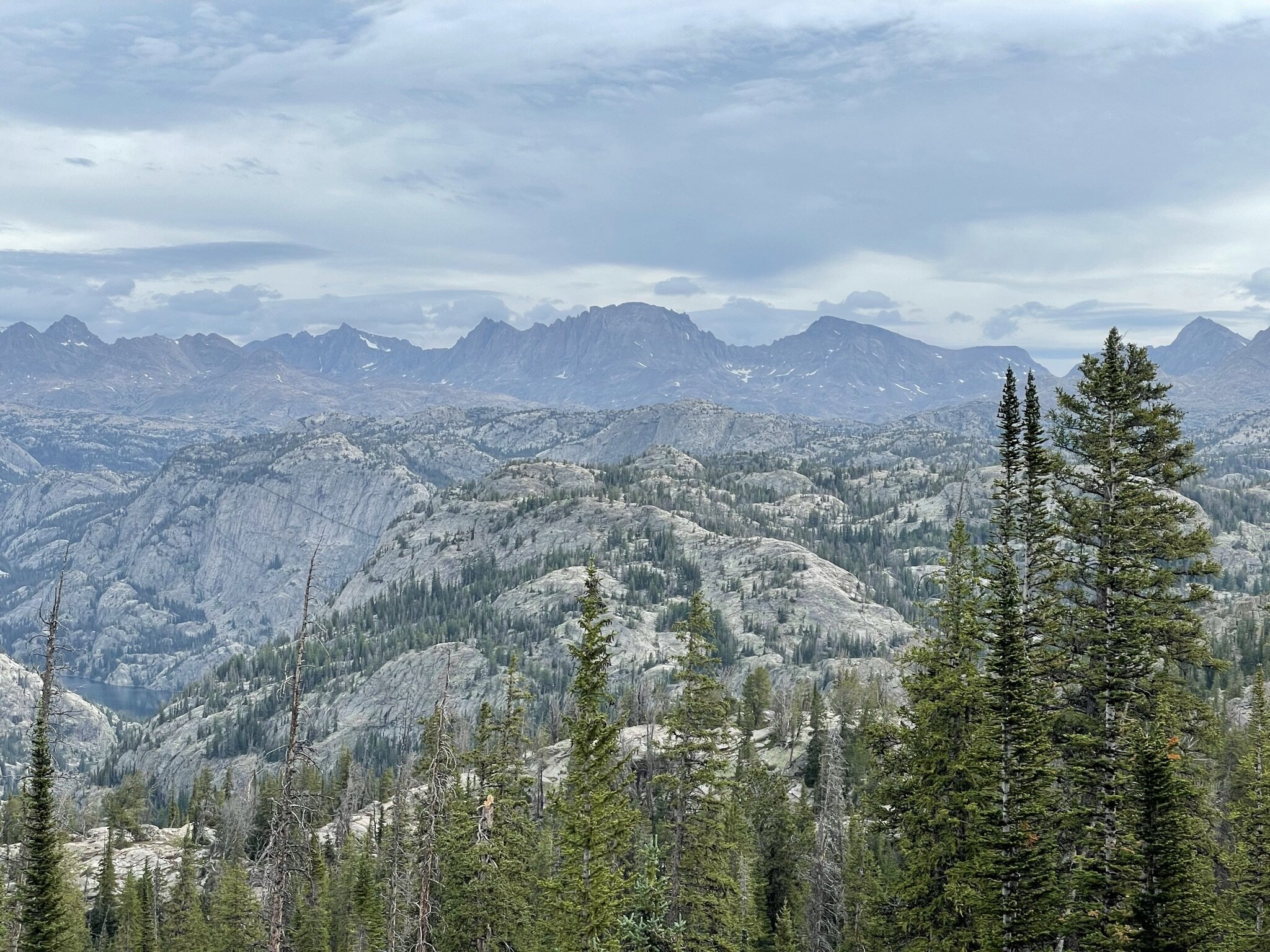
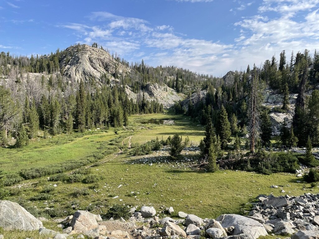
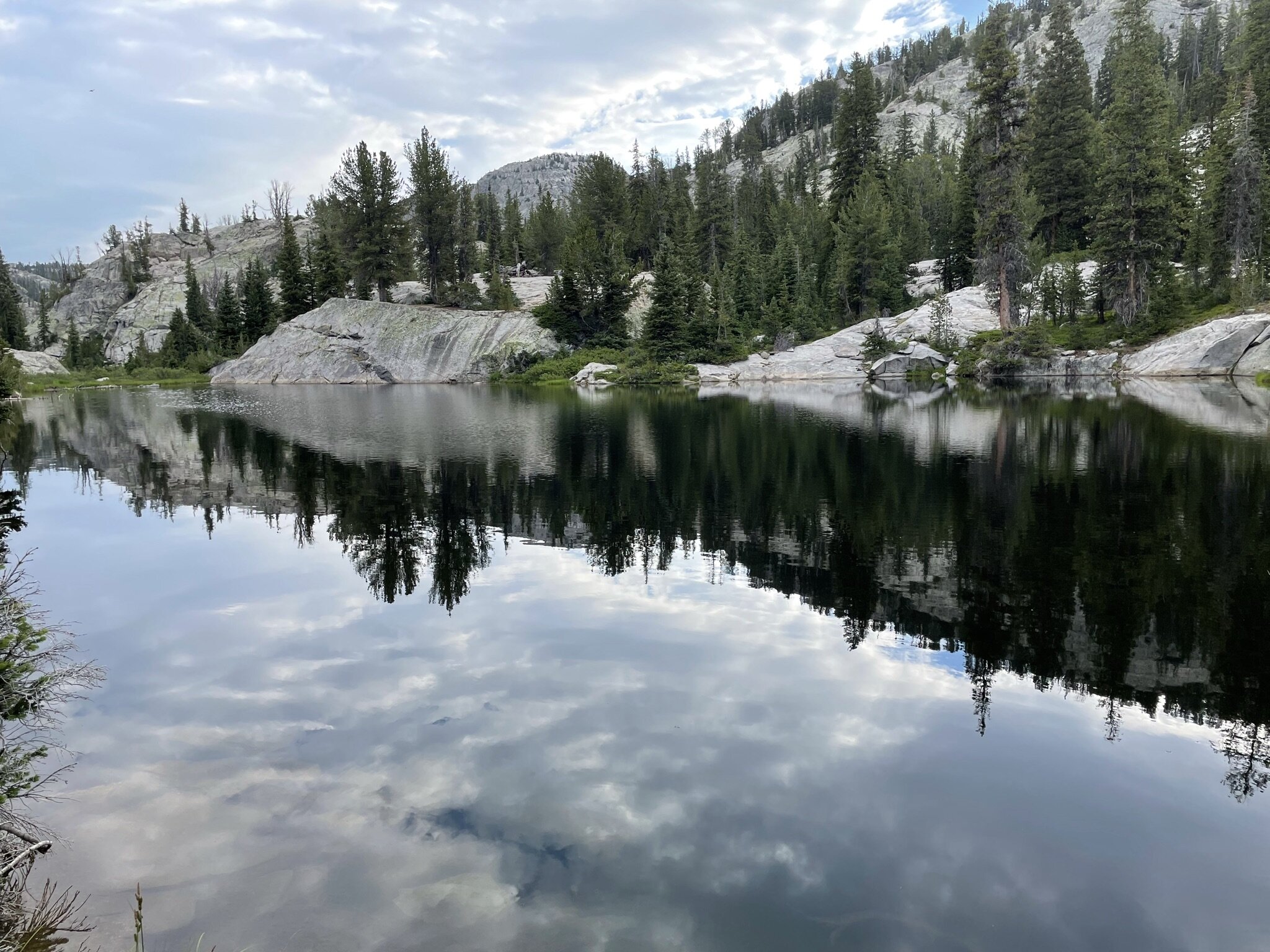
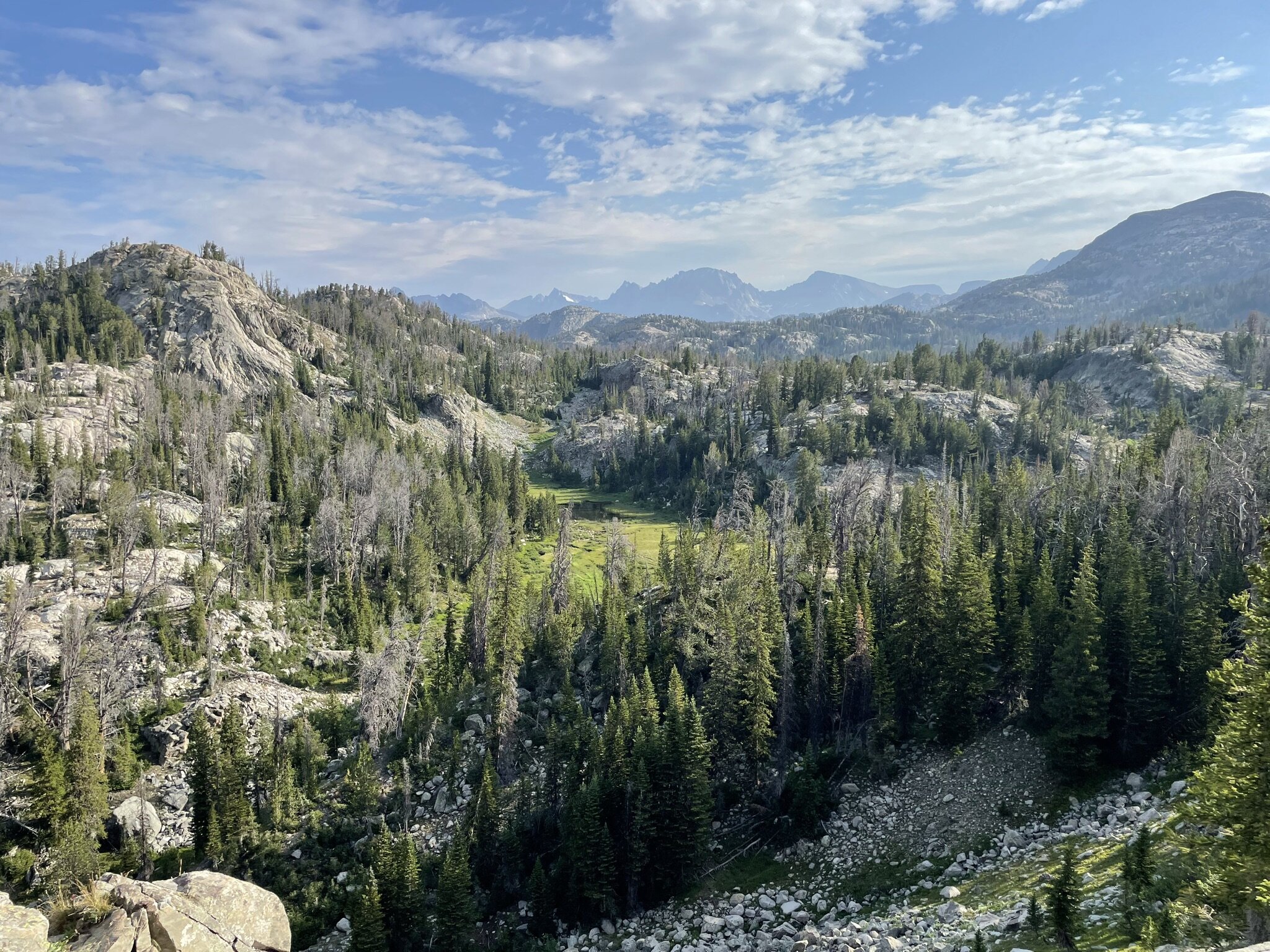
The trail starts off in dense forest for the first few miles, with a brief view of the Wind River Range at Photographer’s Point. Photographer’s Point is the epitome of what you would want as a rest stop. It offers amazing views of the mountain range from afar, and lots of open area to lay out gear, have a snack, or take a quick nap. From Photographer’s Point, the trail started to open up from the dense forest we grew accustomed to in the first few miles. Once above treeline, every step felt like “Christmas morning”. The terrain was open and vast with great views of mountains, boulders, and lakes as far as you could see. First up was Hobbs Lake on the right side of the trail. This ended up being our breakfast stop in the morning. After spending some time taking in the views, we decided it was time to keep exploring.
The next major milestone on the hike was Seneca Lake. This is a massive lake compared to the others on the trail and was quite the view as at this point we were continuing to get closer to the mountains. The trail follows Seneca Lake for quite some time, and there is only a quick pause before you can see Little Seneca Lake. Shortly after you pass both lakes, the trail runs into the Continental Divide Trail. This was a milestone for all of us hiking as none of had ever been on the CDT before. The trail is merged with the CDT until shortly before Island Lake. Before Island Lake there was some ascending and at this time some poor weather arrived. We ended up taking shelter in the boulders to wait out the rain and hail before pressing on.
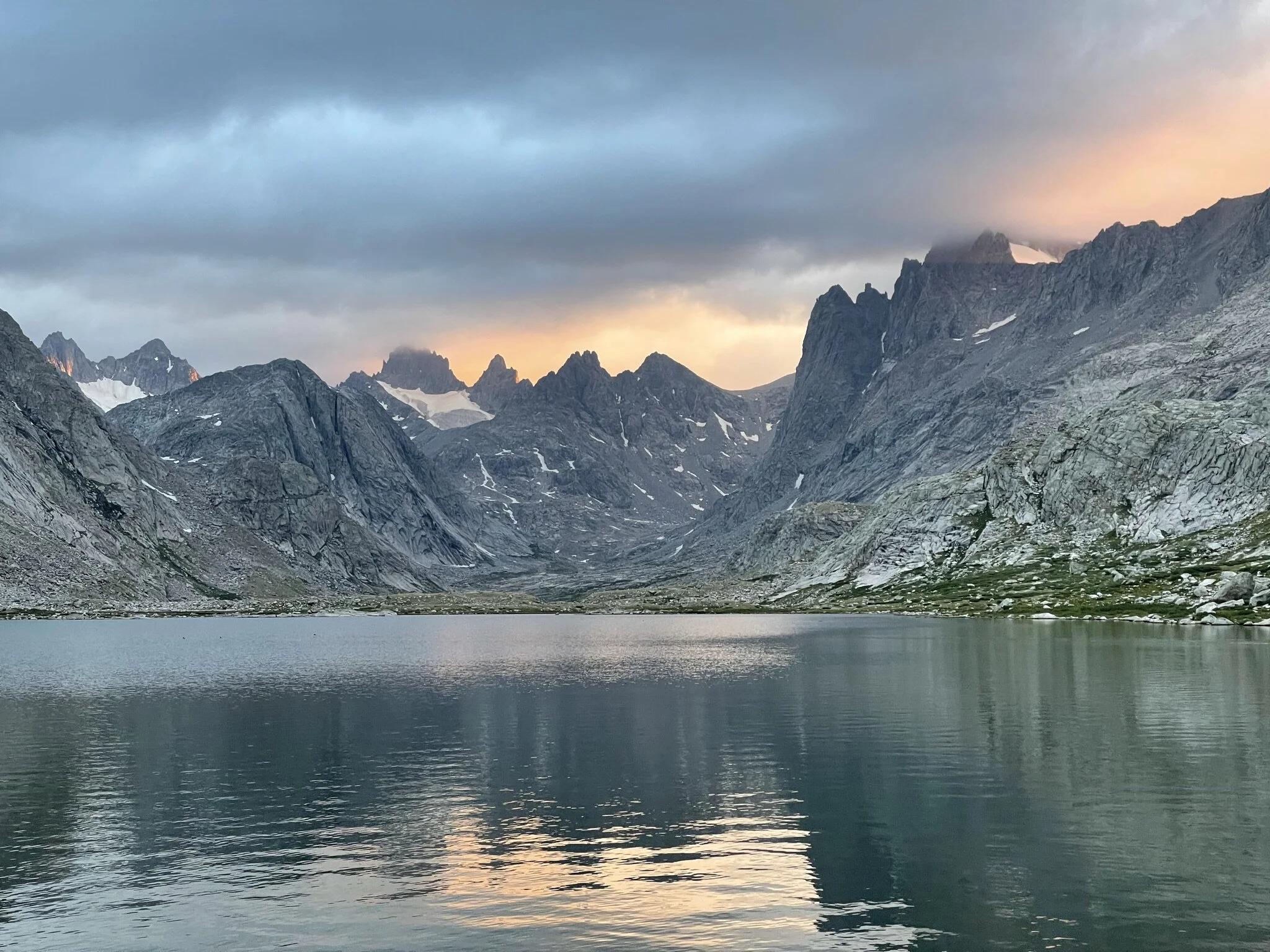
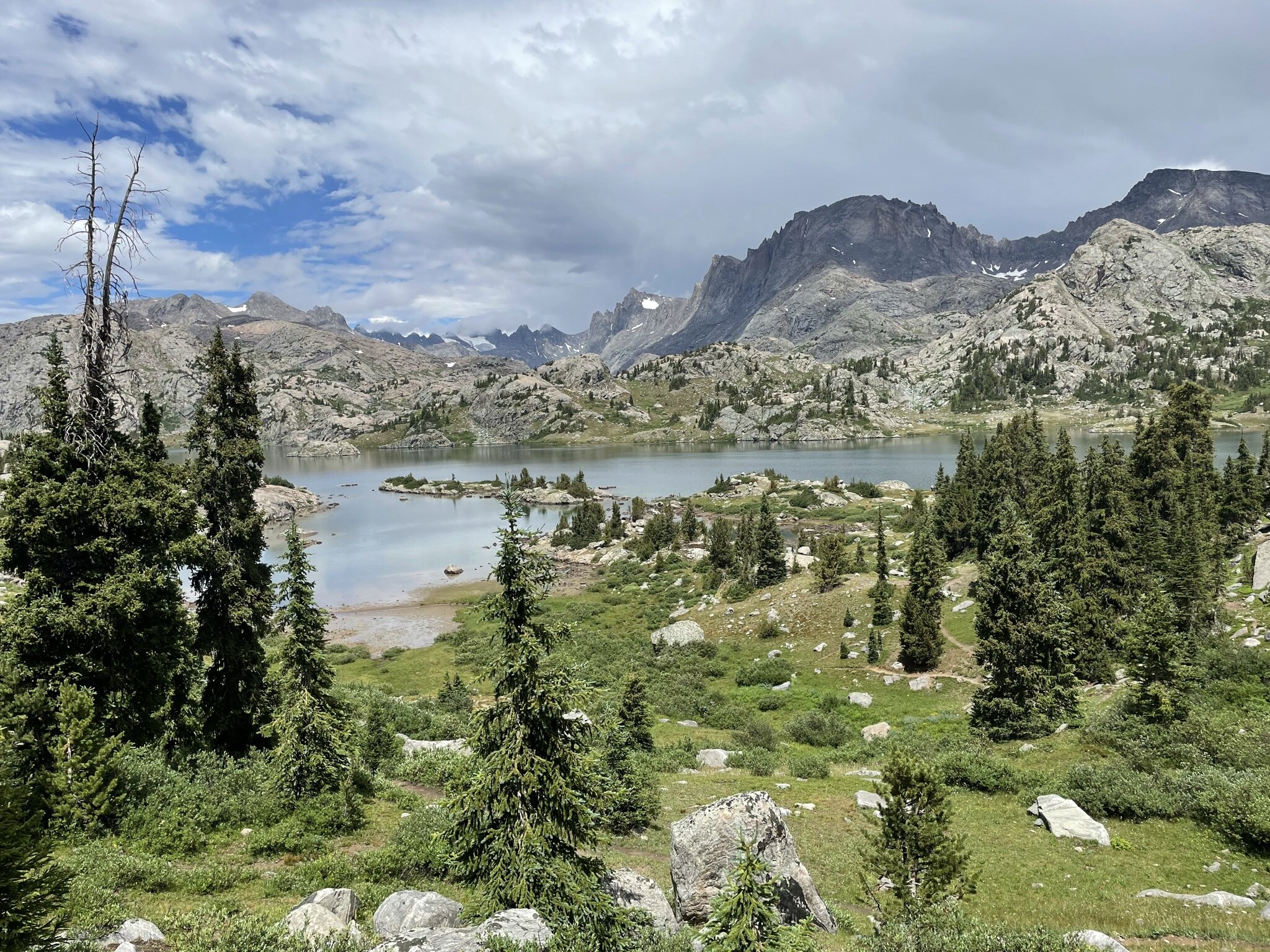
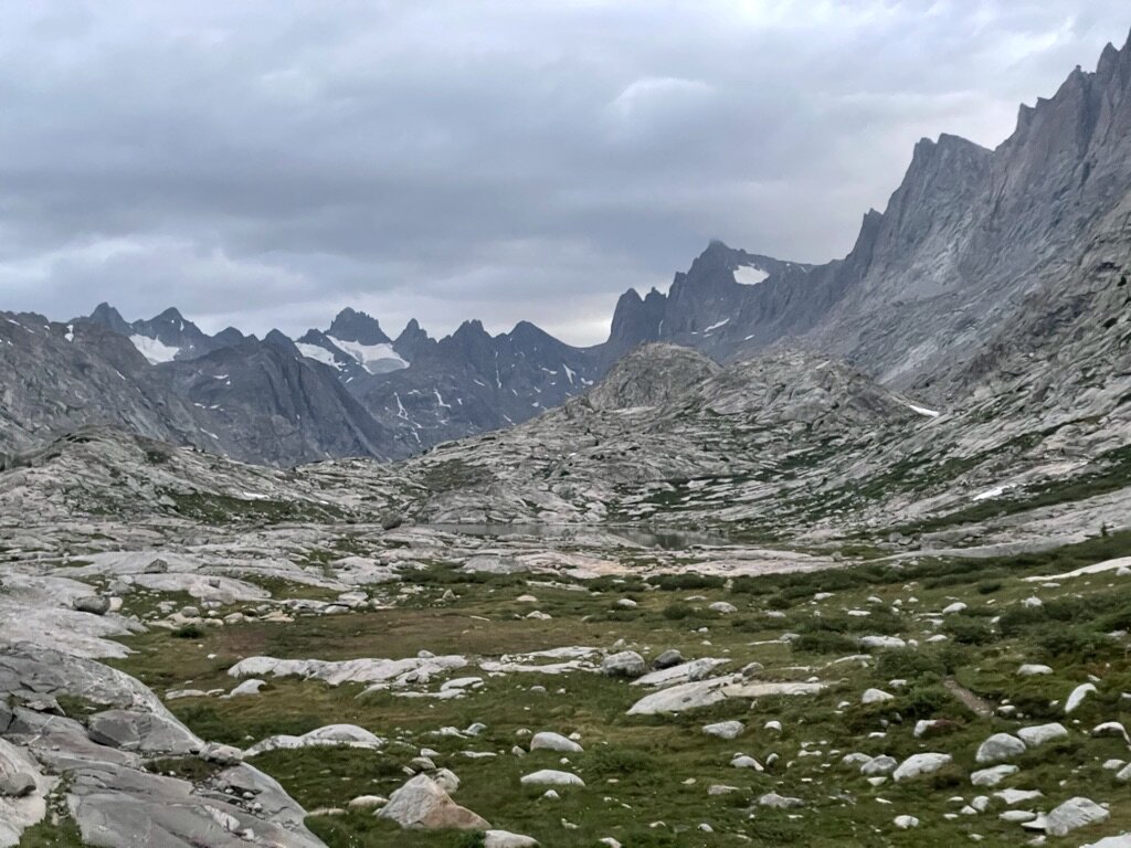
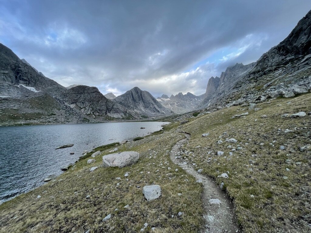
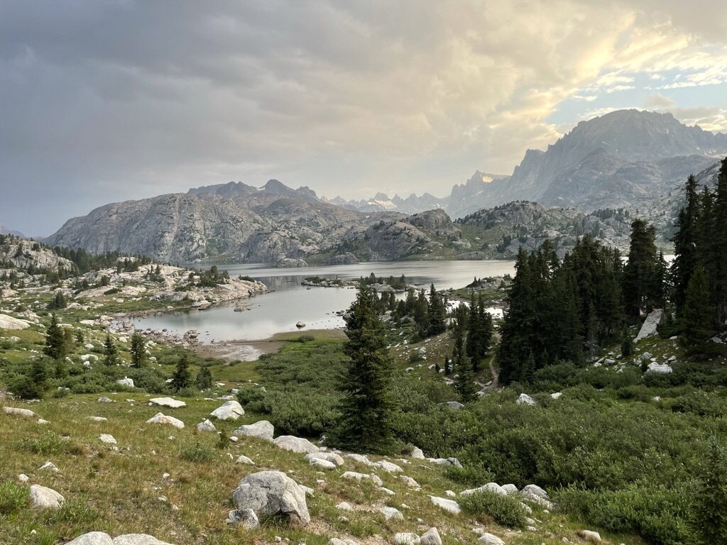
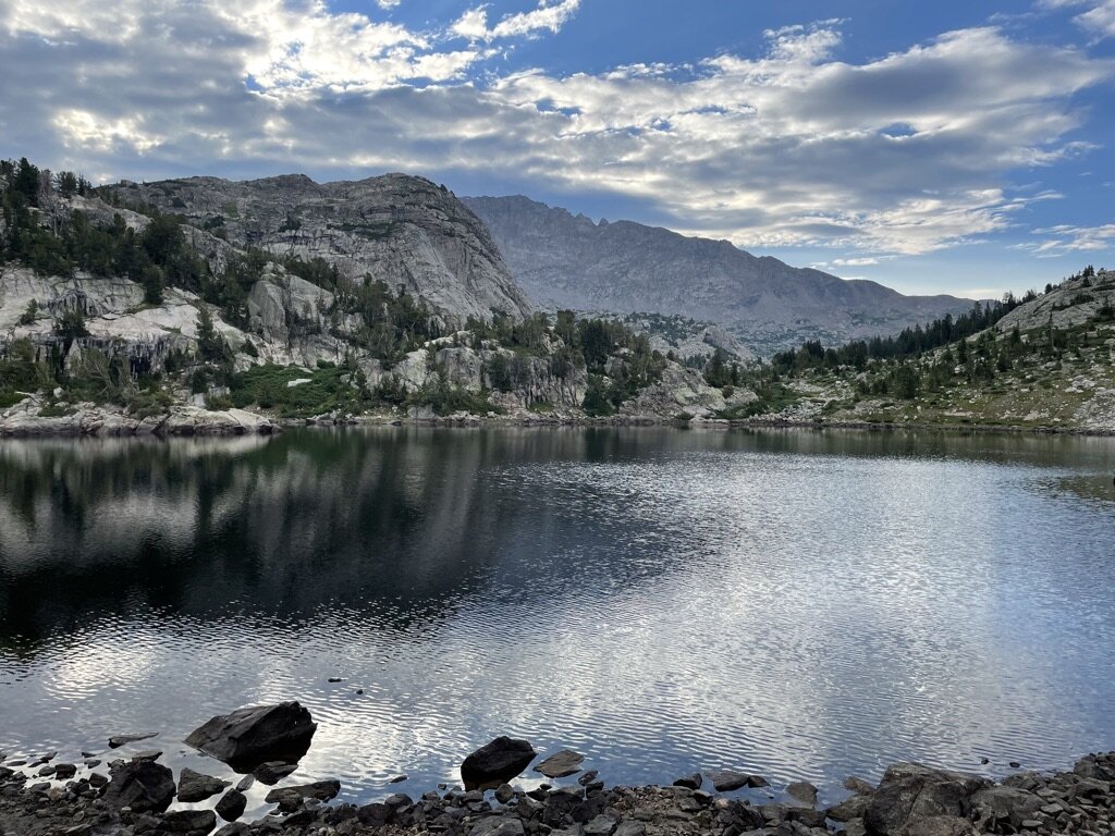
Finally, as the weather started improving, we got our first glimpse of Island Lake. It was a view I will never forget as it was unimaginable. The depth and magnitude of the mountains, lakes and terrain is something that is hard to put into words. We weren’t sure what to do, so we just kept hiking to see more of the lake. We ultimately got to the northern side of the lake and decided to look for a place to camp.
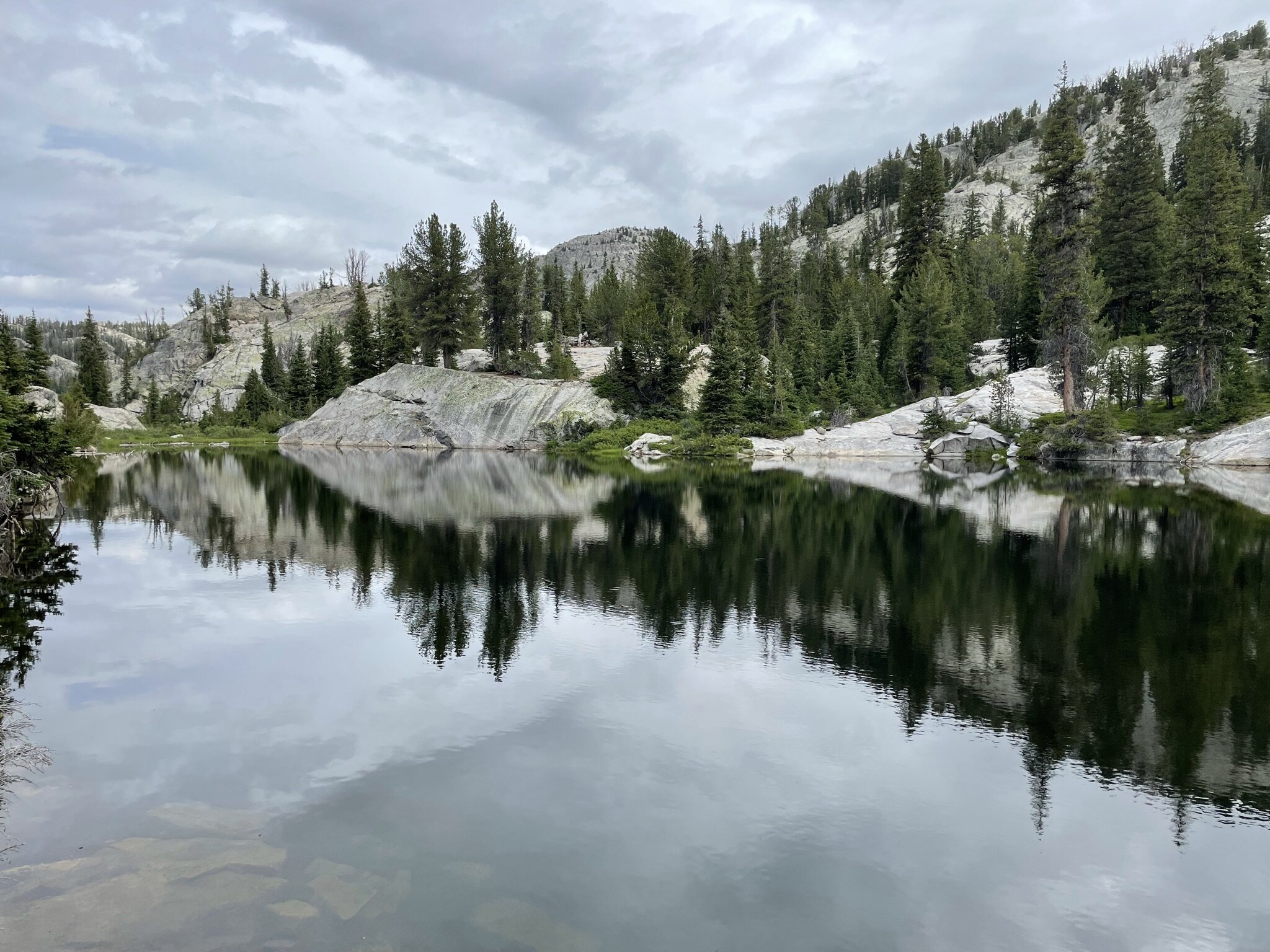
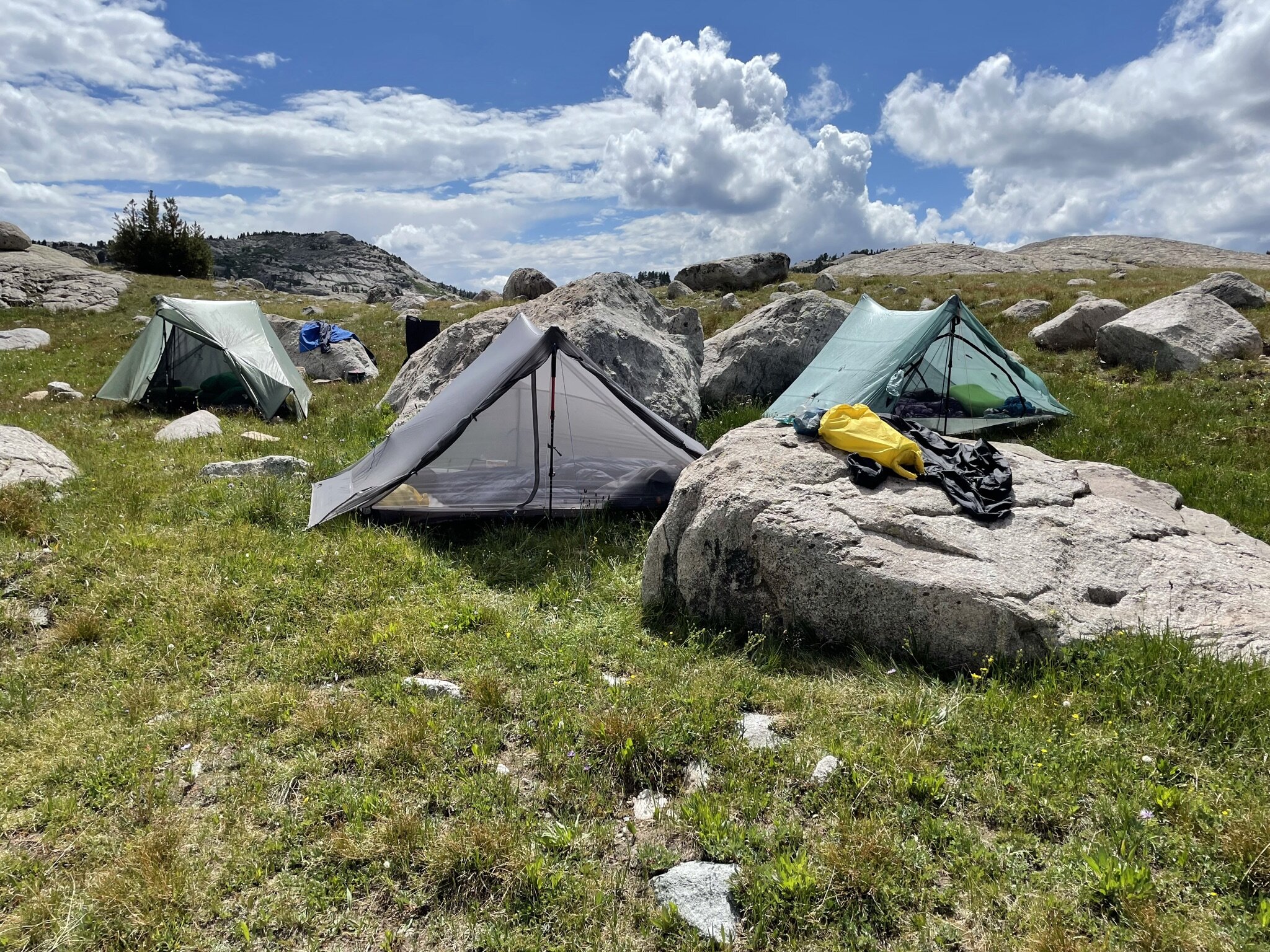
We ended up hiking closer to Titcomb Basin, which was at higher elevation and more exposed to wind, so we turned around and decided camping at Island Lake was the right choice. We started setting up camp in the early afternoon. With time to spare, we decided we would swim in the lake, make dinner, and I would try my hand with a Tenkara Rod that I had picked up in Pinedale at The Great Outdoors Shop. Unfortunately, there won’t be any fish pictures on this hiking report, as we didn’t spend too much time fishing, being pretty tired out each day from all of the hiking! To conclude the momentous day, we played cards while listening to music and the calm of the evening.
Day 2 - Island Lake to Knapsack Col & Indian Basin
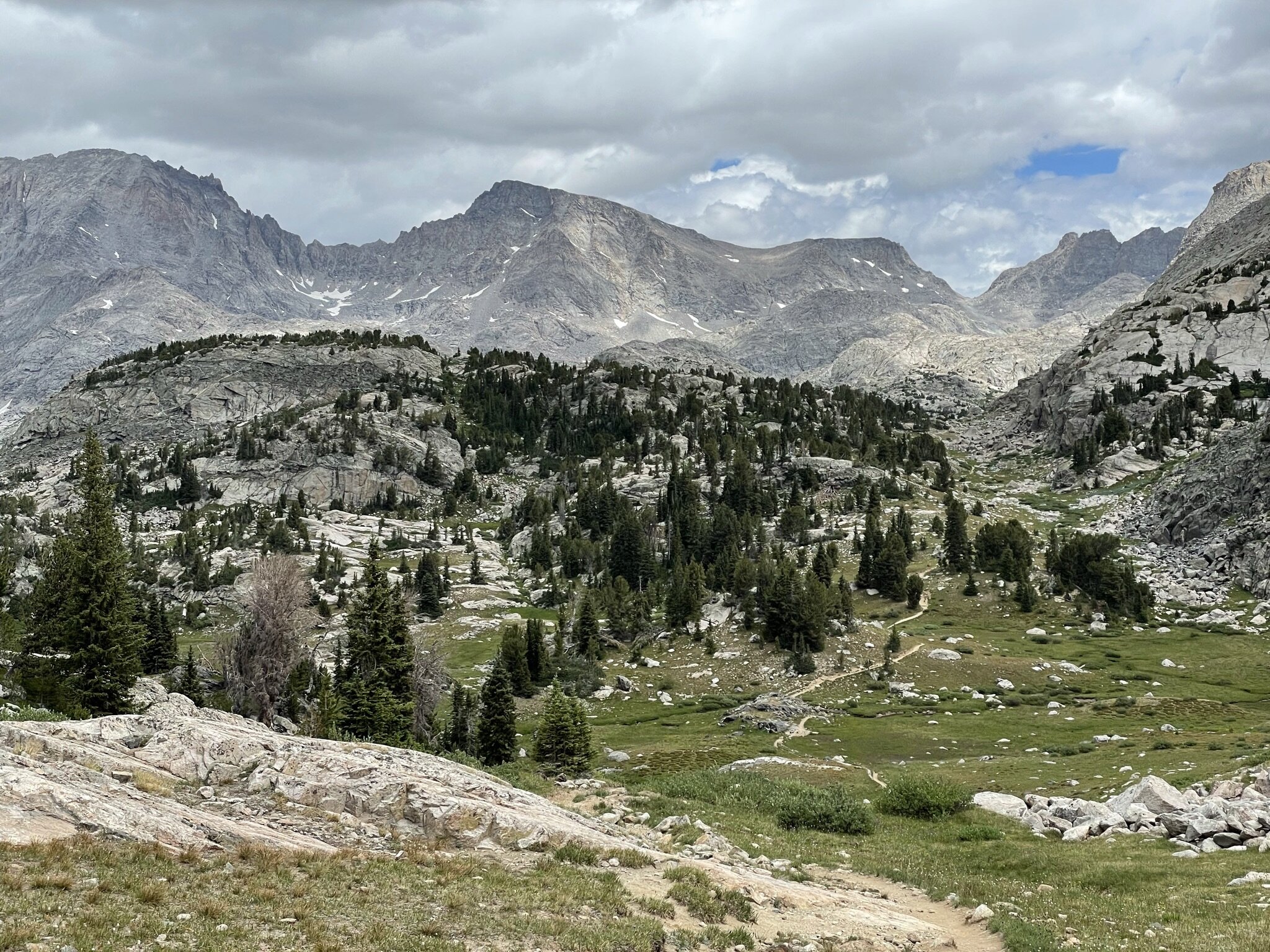
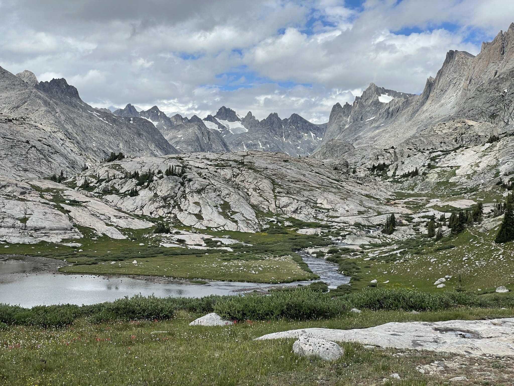
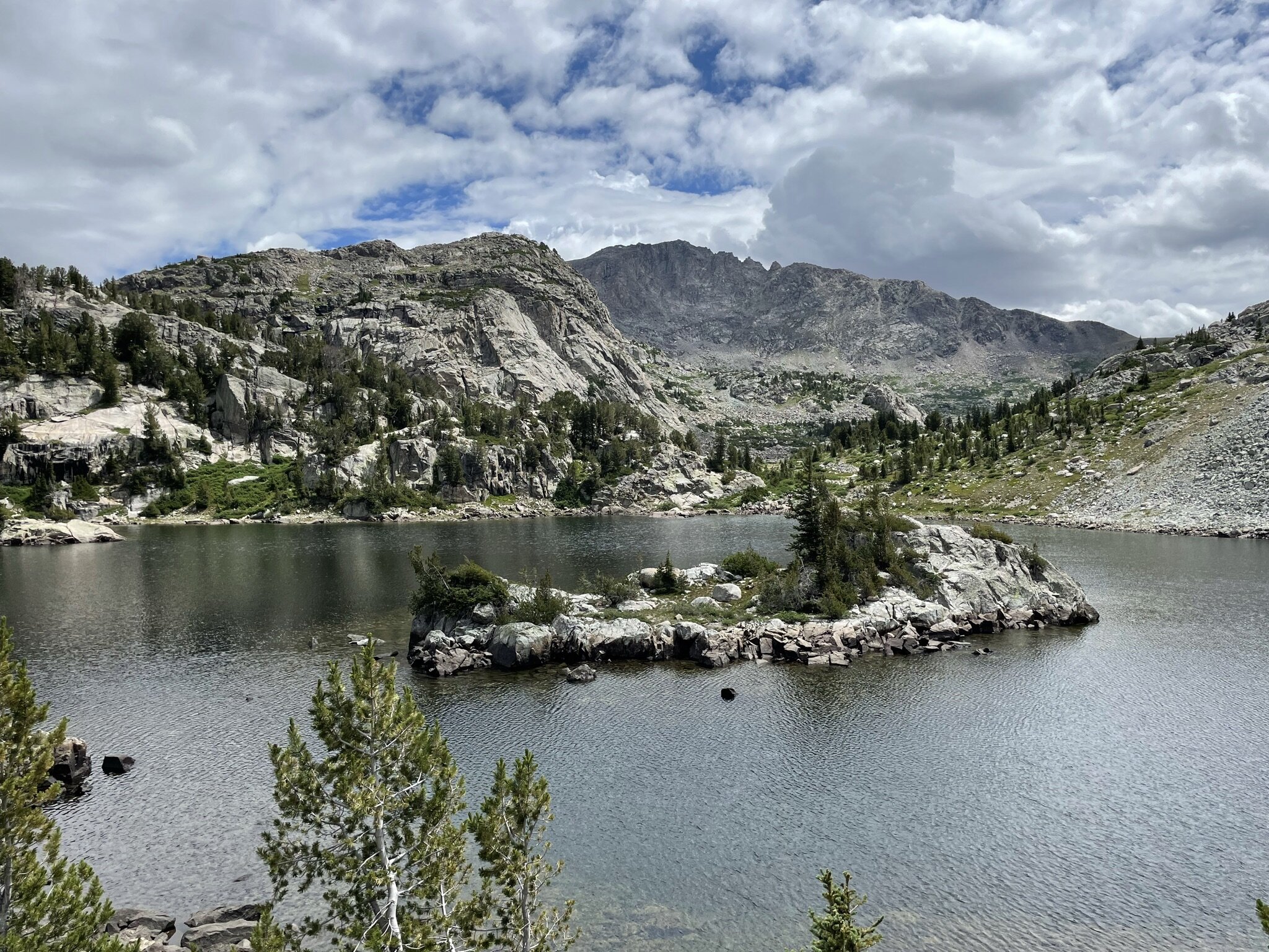
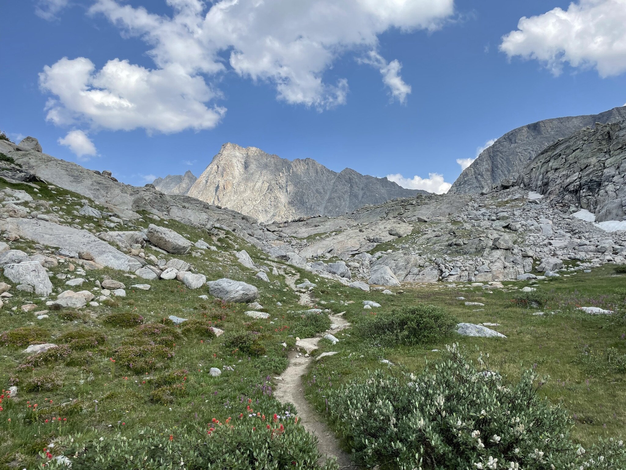
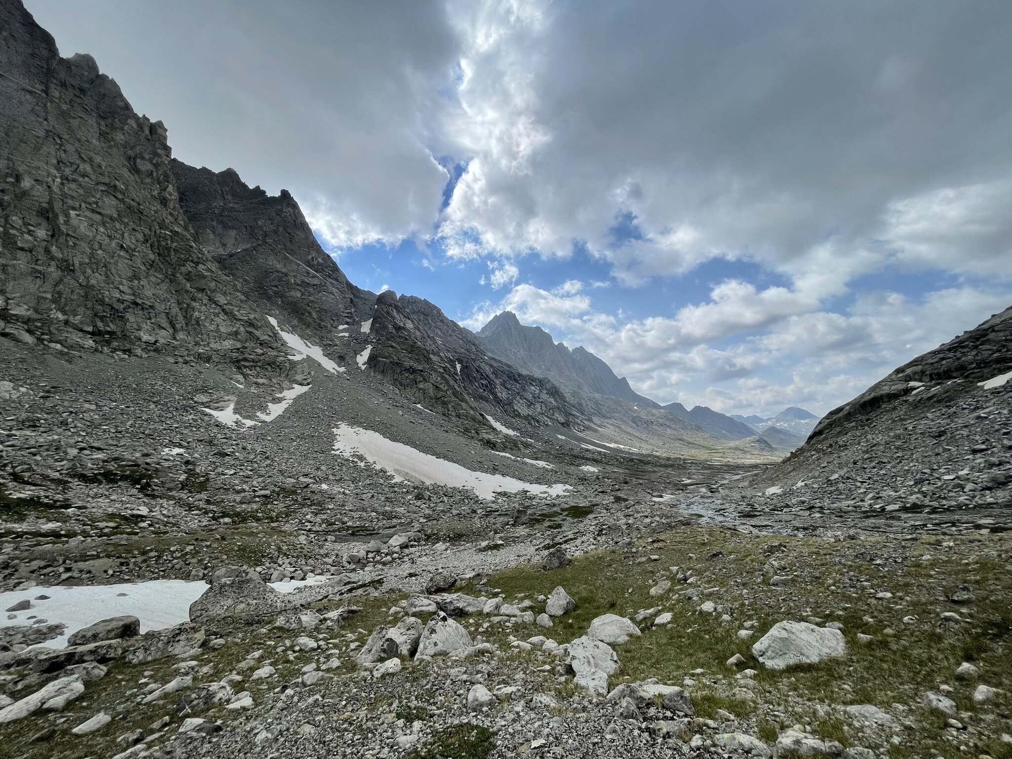
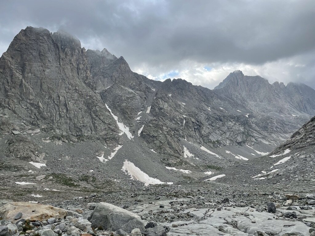
This was, in my opinion, the best day of our vacation and my favorite day hiking/backpacking ever. We woke up early and as I looked out of my tent, I saw Fremont Peak staring at me. I knew it was going to be a great day in the mountains and I was anxious to get started! We only needed to hike 2 miles to get into the start of the Titcomb Basin, but although you can see quite a ways in the distance, sometimes the depths are misleading. We hiked past both of the Titcomb Lakes on our way to the basin itself. We ended up taking a break at the second of the Titcomb Lakes and found a fellow Michigander. Once we got to the basin, we actually made a few wrong turns trying to find the “trail”. At this point there really wasn’t an established trail, and since we knew we had to go up, we tried finding the easiest route to do so. This is also where the hiking turned from dirt path to large rocks. Combine this with increasing altitude, and our pace started to slow down quite a bit. Thankfully for us, we elected to fastback Day 2 by leaving our tents, sleeping bags, and other gear back at our base camp. This really helped us travel light and push ourselves a bit further, knowing we didn’t have 20 pounds on our backs.
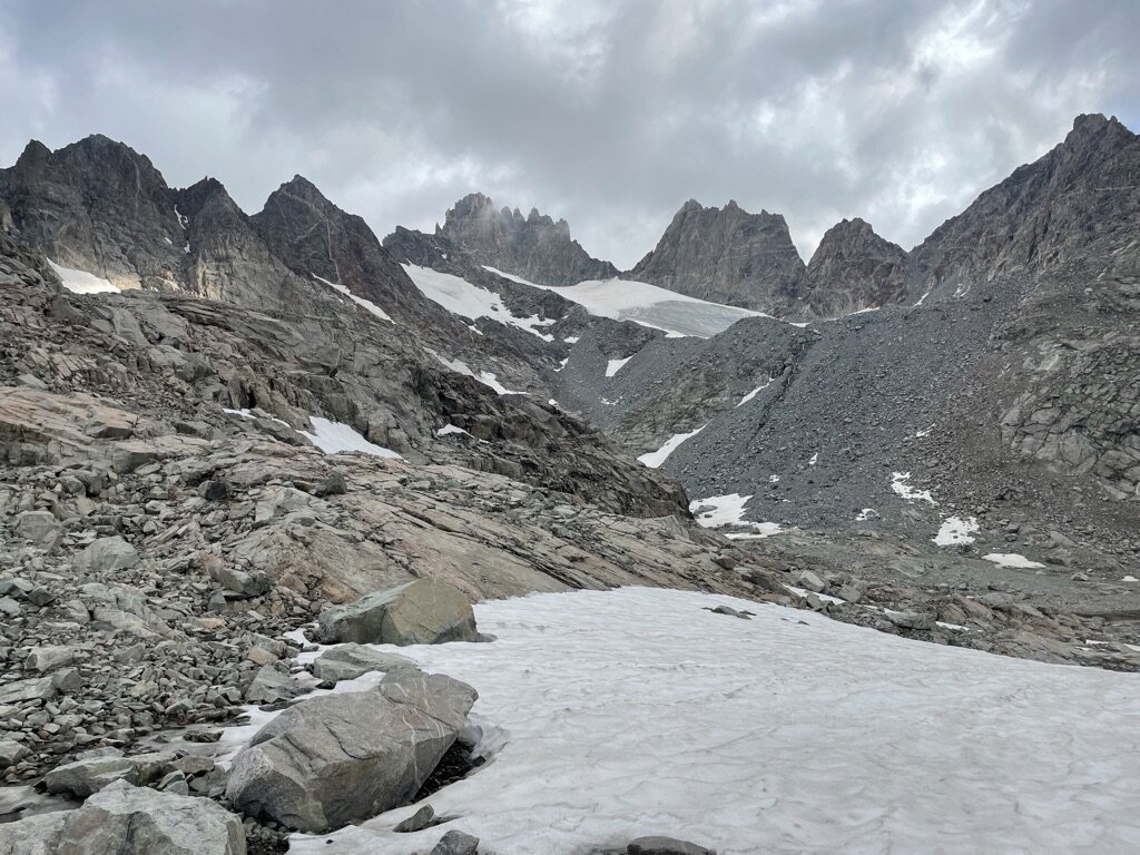
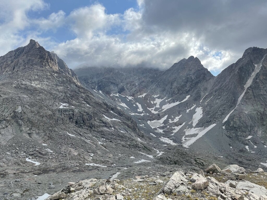
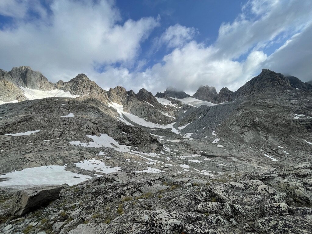
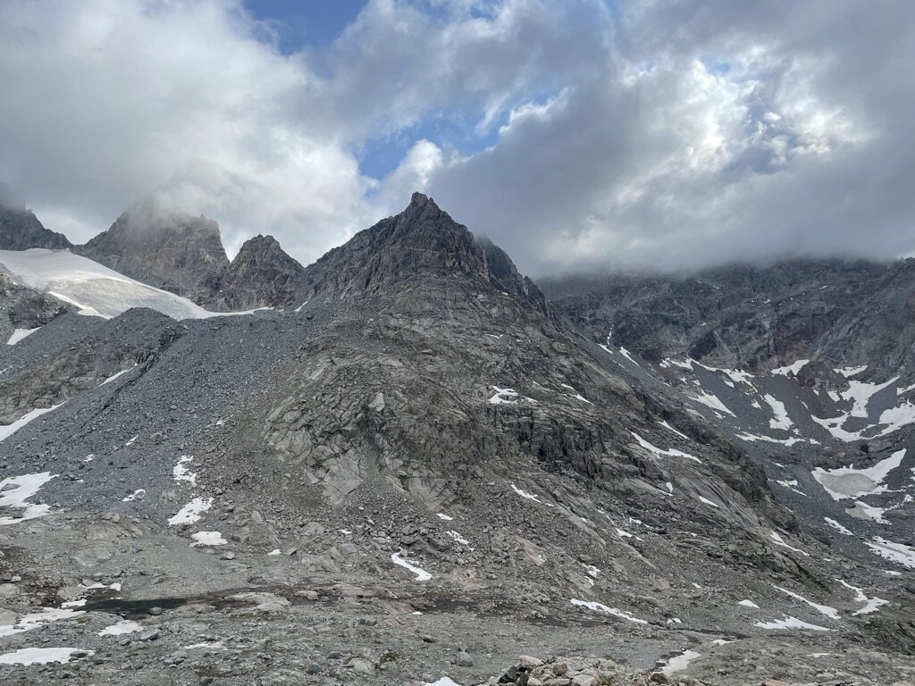
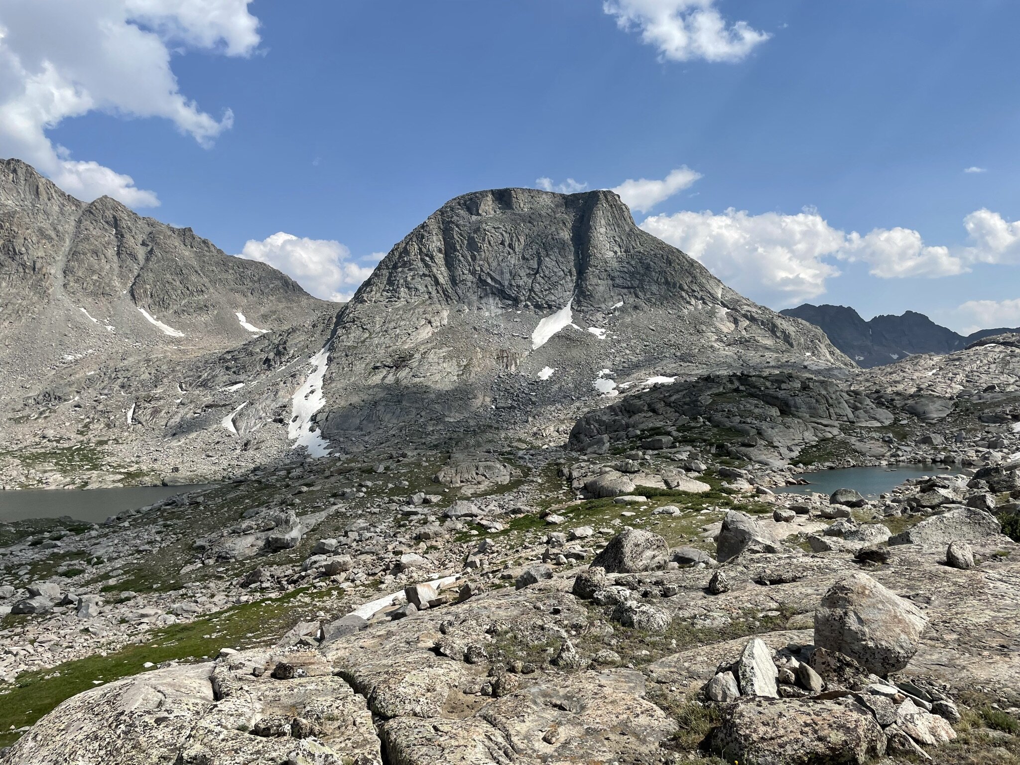
This last mile or so took a very long time. We were all feeling the terrain and altitude. I was so excited to get to the top that I pressed on as fast as my body would allow. The views at this point were engulfing us. We could see massive mountains and snow! The sound of glacier-fed streams motivated us onward. Eventually, I got to what I thought was a good stopping point as I could see 360 degrees in this range. Some notable mountains we could see from here were: Knapsack Col, Fremont Peak, Twins Peak, Woodrow Wilson, Helen, etc.). It was at this point, with 360 degree views of the Wind River Range, that I knew the decision to take on the Winds was absolutely the right decision. It was a moment that I will never forget, and I couldn’t stop smiling the entire time!
After taking many pictures, relaxing, and taking it all in, we decided it was time to start the return trip back to base camp. We took this pretty slowly as the terrain was very rocky and sometimes going down is harder than going up, especially when the ground is loose. On the return trip, we stopped at the second Titcomb Lake (closest to the Basin) for a late breakfast. I took a quick dip in the lake and was immediately informed this was a glacier-fed lake! It was the coldest lake I had swam in and even topped Lake Superior in June! After resting at Titcomb Lake, we powered through the last 4-5 miles to base camp. We got back to base camp around 1:00. It was a collective decision that we would nap for a couple of hours and see how we felt from there.
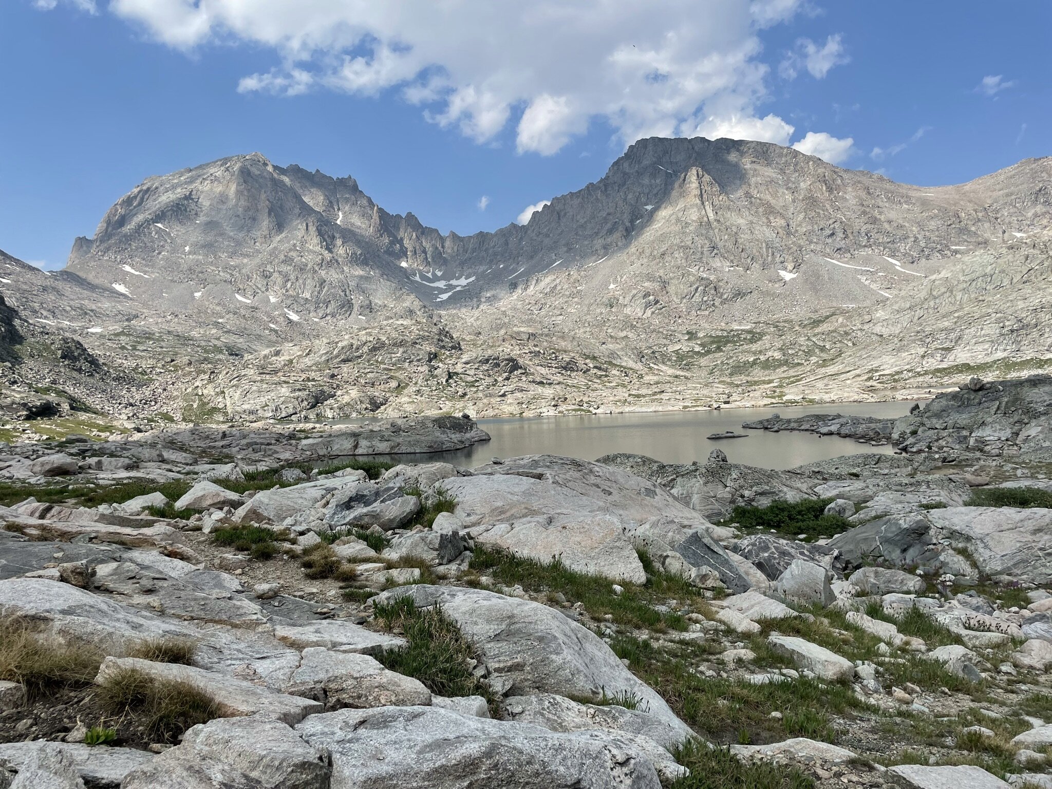
Upon waking up around 3PM, we decided we had a little bit left in the tank. We all agreed we would see how far we could get with an initial goal of Indian Basin and a stretch goal of Indian Pass. Knowing we had already climbed quite a bit that day, I think we all knew deep down that Indian Pass would be quite the feat, but it was this stretch goal that helped motivate us to at least make it to Indian Basin! Once in Indian Basin, we spent some time taking in new views of Fremont Peak, and a new mountain called Elephant Head. We relaxed here, taking it all in for a while, then ultimately determined Indian Pass wasn’t going to happen and we would be “saving” that for a future trip! We returned to base camp around 5 and passed the time playing cards, cleaning up and eating. This day was about 17 miles in total, with over 3,000 feet of elevation gain.
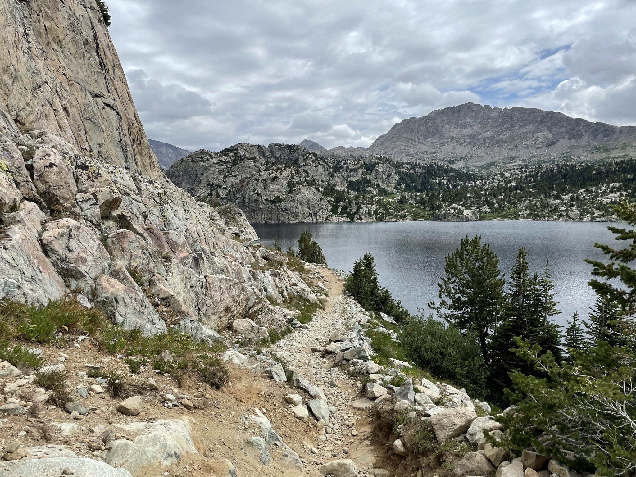
Day 3 - Island Lake to Elkhart Park
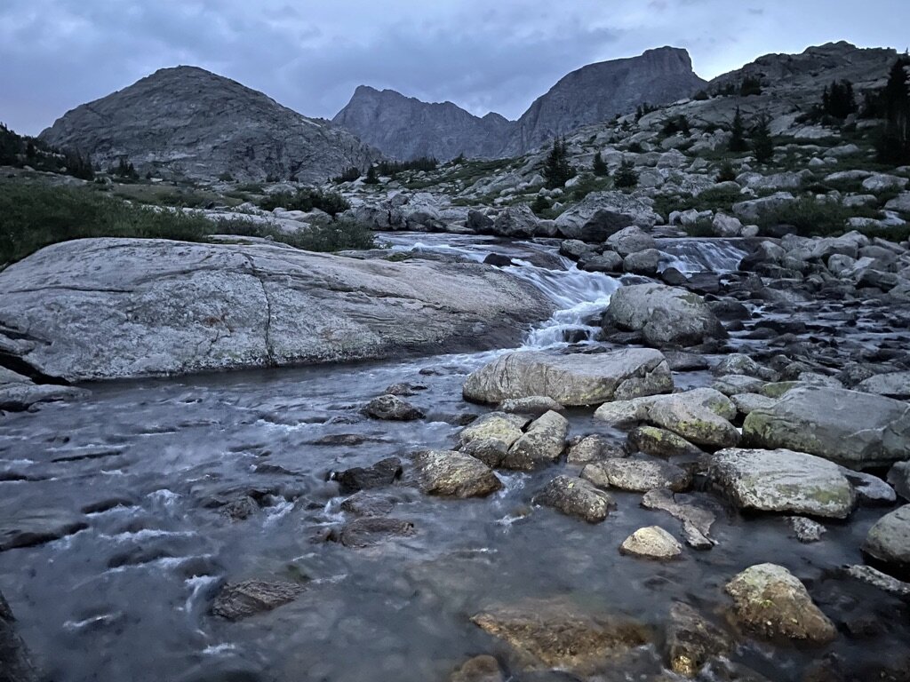
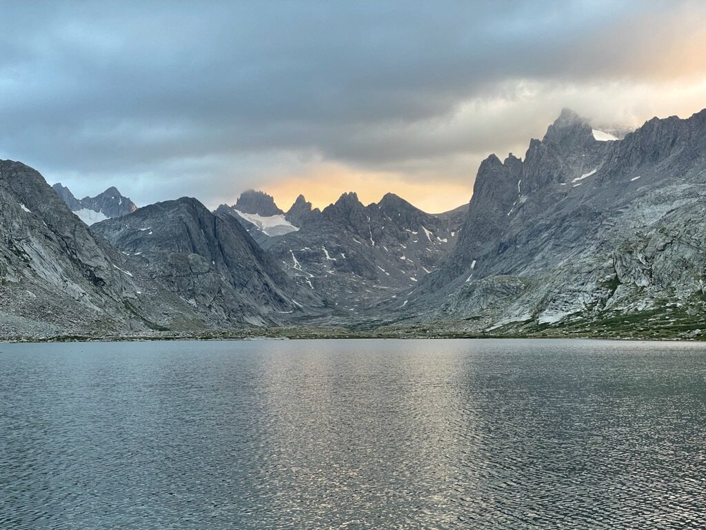
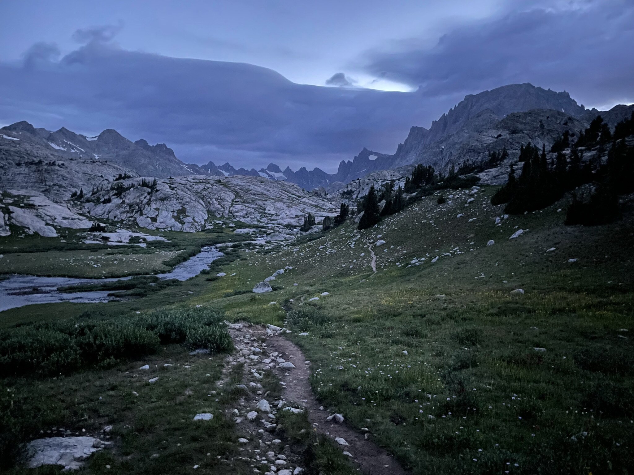
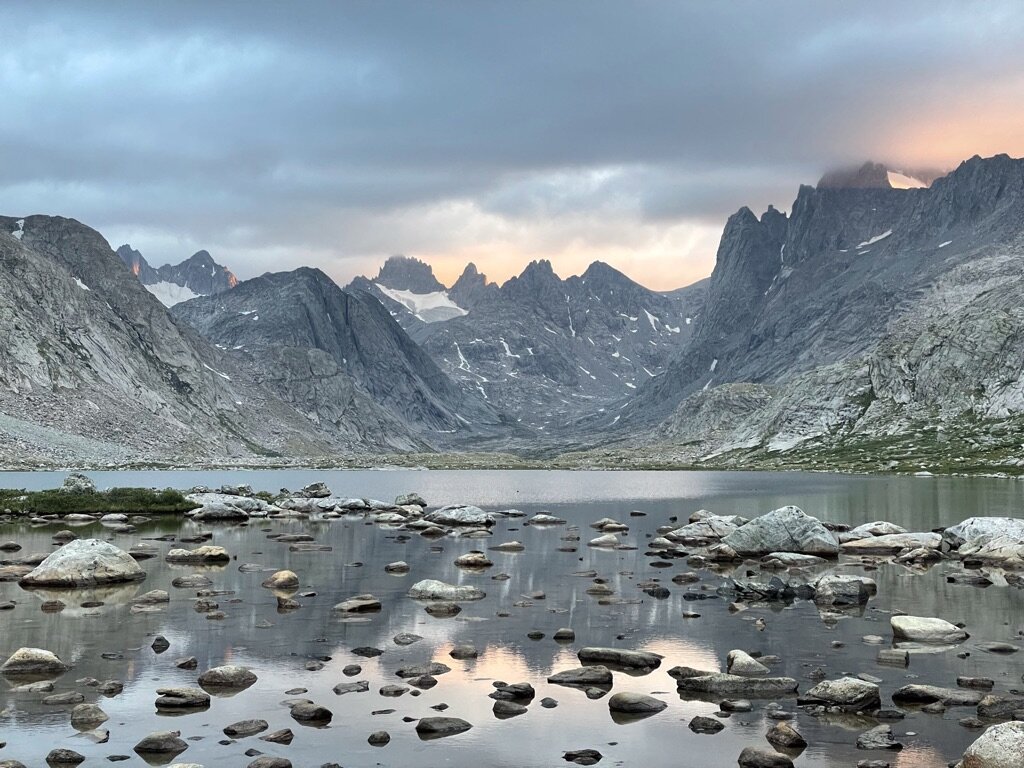
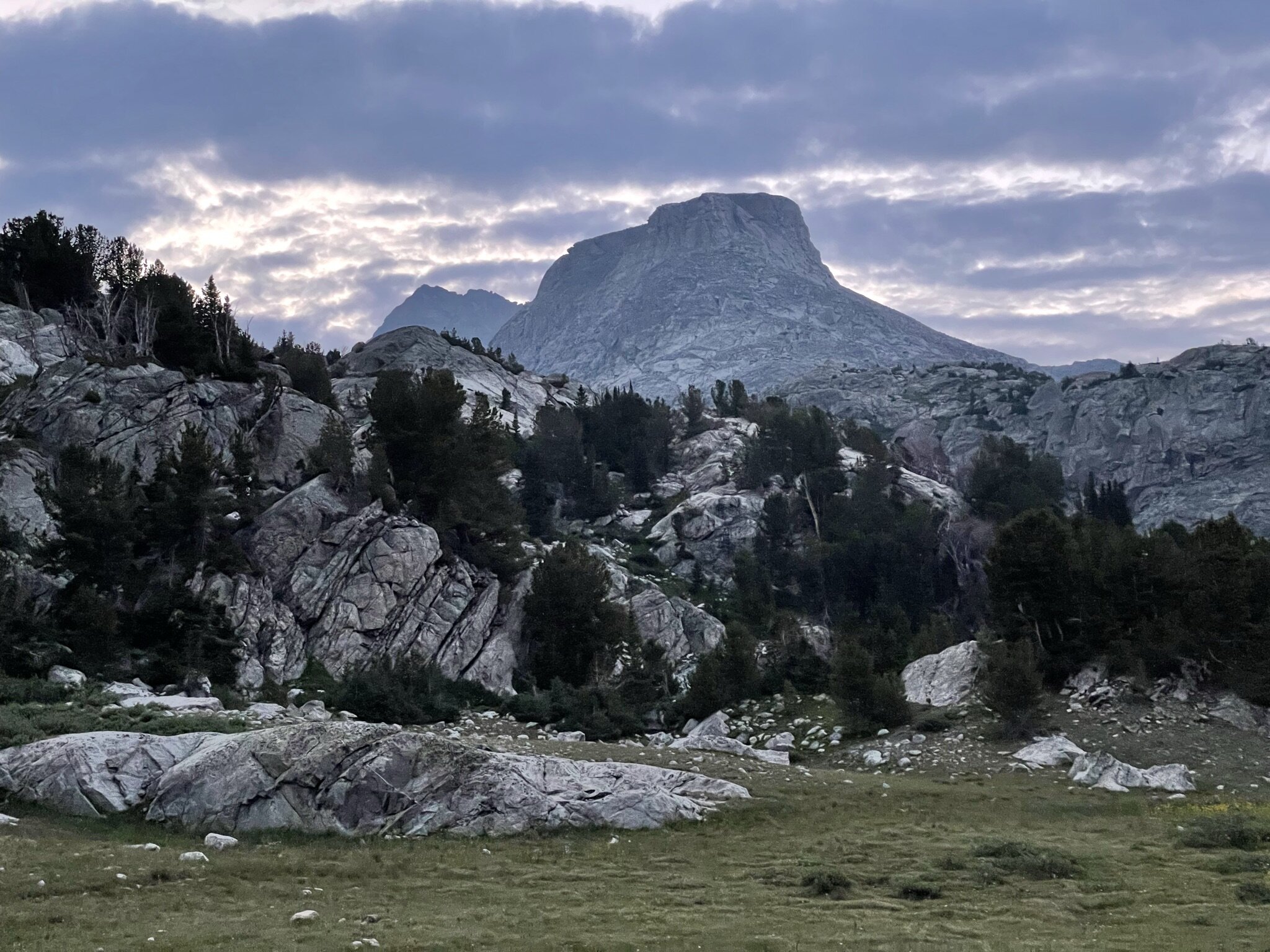
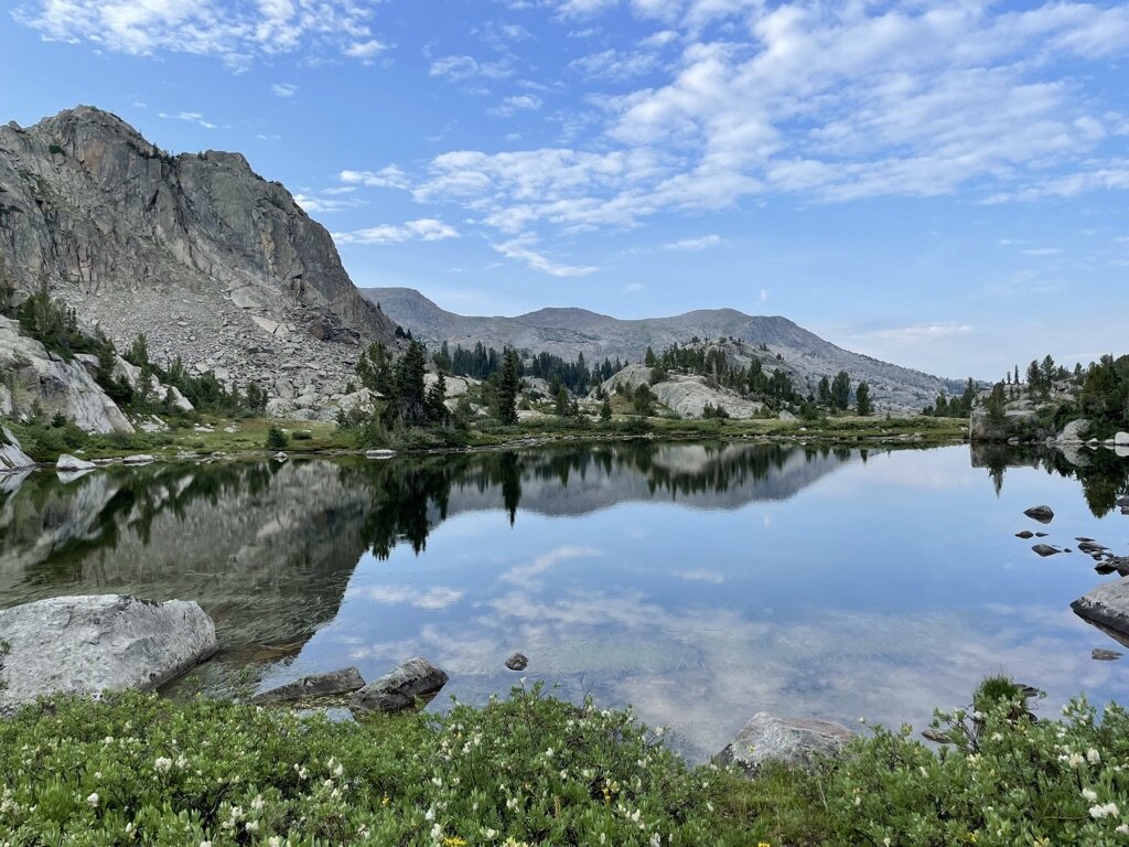
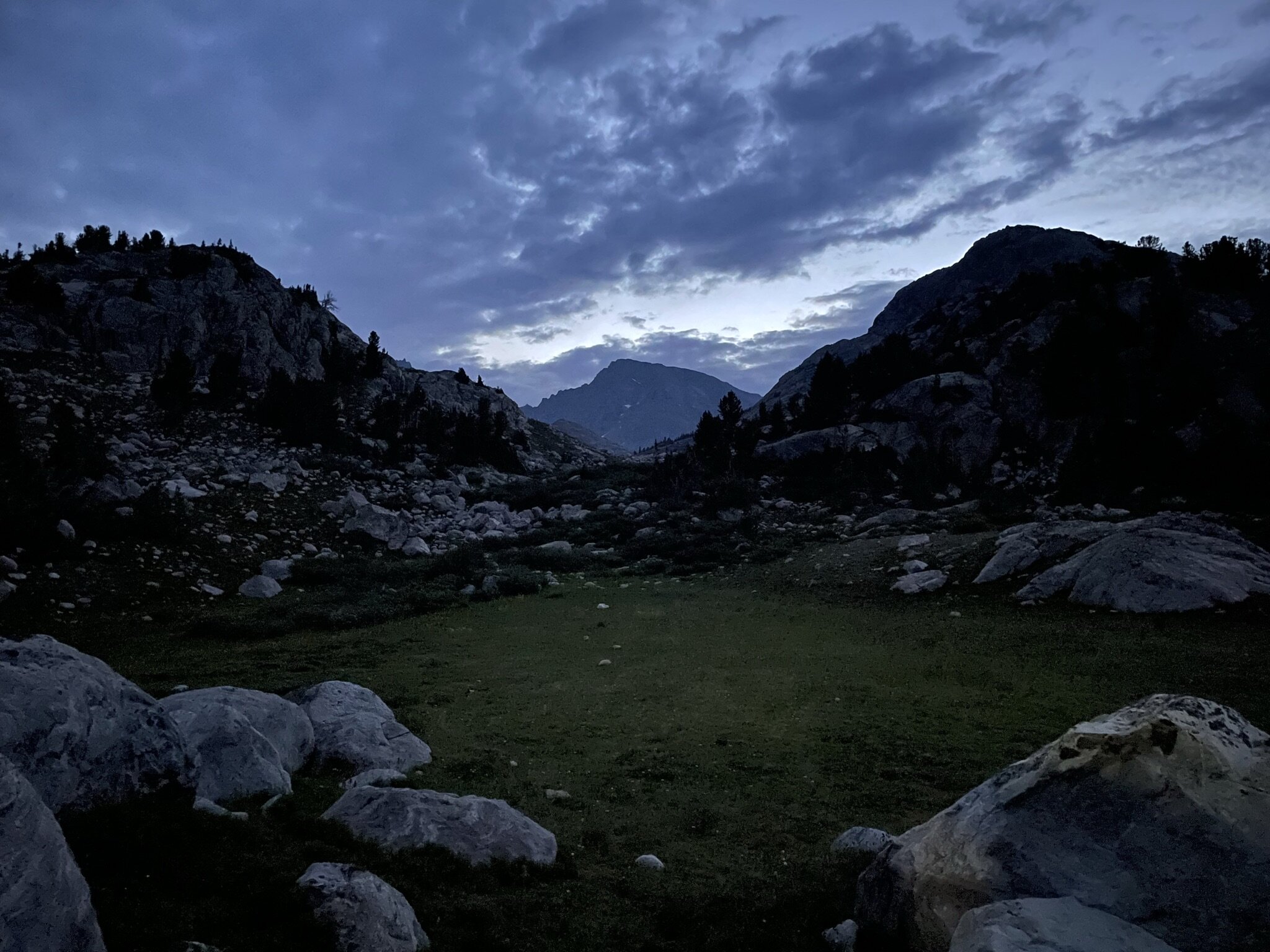
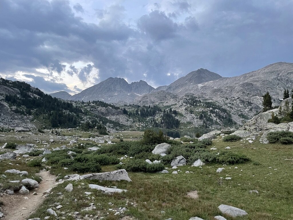
This day ended up being very similar to Day 1, which is likely not much of a surprise considering this is a large out-and-back hike. With that being said, the terrain offered unique perspective hiking in reverse and little allure was lost on Day 3. I think part of this was having a day in between Day 1 and 3 to help switch things up. I guess when you are in some of the best hiking terrain in the country, it’s a little different experience doing “repeat miles”. Anyway, I will keep it short and sweet here, considering Day 1 is highlighted in detail. The only notable here is waking up early on Day 3 offered some incredible views and photos due to the combined lighting and cloud coverage. I’ll include some photos below to show the contrast that time of day and cloud coverage can have on photography!
Photos
Photos taken on this trail are with my iPhone 12 Pro.